P.Z. 06-2019 17627 & 17659 N. Outer 40 Road (Andrew Brown)
NOTICE OF PUBLIC HEARING
CITY OF CHESTERFIELD
PLANNING COMMISSION
NOTICE IS HEREBY GIVEN that the Planning Commission of the City of Chesterfield will hold a Public Hearing on Monday, April 22, 2019 at 7:00 p.m. in the Council Chambers at Chesterfield City Hall, 690 Chesterfield Parkway West, Chesterfield Missouri 63017.
Said Hearing will be as follows:
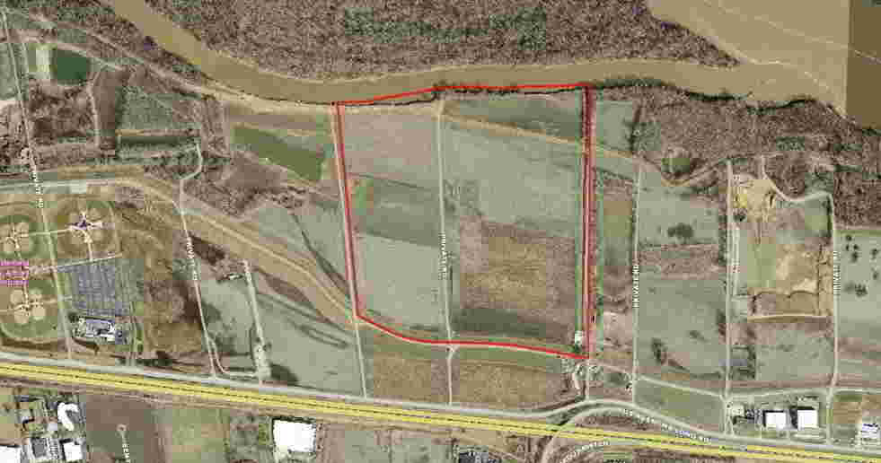
P.Z. 06-2019 17627 & 17659 N. Outer 40 Road (Andrew Brown): A request for a zoning map amendment from the “FPM3” Flood Plain Planned Industrial District to the “AG” Agricultural District for a 153-acre tract of land located on the north side of North Outer 40 Road. (16U110023 and 16V320067)
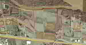
For a larger image of the site, please click HERE.
Anyone interested in the proceedings will be given an opportunity to be heard. Copies of the request are available for review in the Department of Planning & Development Services at Chesterfield City Hall, 690 Chesterfield Parkway West during weekdays between the hours of 8:30 a.m. and 4:30 p.m. If you should need additional information about this project, or for a list of requested uses, please contact Ms. Jessica Henry, Assistant City Planner, by telephone at 636-537-4741 or by email at jhenry@chesterfield.mo.us
CITY OF CHESTERFIELD
Merrell Hansen, Chair
Chesterfield Planning Commission
Property Description
Property description is of that part of parcels in the title commitment North of the center of the Monarch Chesterfield Levee:
A tract of land being part of Lots 2 and 3 of Damian Kroenung Estate, and part of U.S. Surveys 126 and 1010, Township 45 North – Ranges 3 and 4 East, St. Louis County, Missouri and being more particularly described as follows:
Beginning at a point in the West line of property described in deed to the City of Chesterfield, Missouri, recorded in Book 17745 page 5575 of the St. Louis County Records, said point being distance North 01 degrees 20 minutes 26 seconds East 382.41 feet from the intersection of said West line with the North line of Missouri Interstate Highway 64, varying width, as described in Book 6343 page 824 of the St. Louis County Records; thence Westwardly, leaving said West line, along a curve to the left whose radius point bears South 13 degrees 25 minutes 43 seconds West 1500.00 feet from the last mentioned point, a distance of 99.84 feet to a point; thence North 80 degrees 23 minutes 06 seconds West 549.06 feet to a point; thence along a curve to the left whose radius point bears South 09 degrees 36 minutes 54 seconds West 3000.00 from the last mentioned point, a distance of 365.07 feet to a point; thence North 87 degrees 21 minutes 26 seconds West 524.85 feet to a point; thence North 88 degrees 21 minutes 03 seconds West 116.56 feet to a point; thence along a curve to the right whose radius point bears North 01 degrees 38 minutes 57 seconds East 910.00 feet from the last mentioned point, a distance of 305.65 feet to a point; thence North 69 degrees 06 minutes 22 seconds West 79.77 feet to a point; thence North 67 degrees 40 minutes 02 seconds West 139.36 feet to a point; thence along a curve to the right whose radius point bears North 22 degrees 19 minutes 58 seconds East 3050.00 feet from the last mentioned point, a distance of 337.29 feet the East line of property described in deed to Brownstone Properties L.L.C. as recorded in Book 20758 page 3332 of the St. Louis County Records; thence Northwardly along said East line North 06 degrees 51 minutes 07 seconds West 2197.48 feet to the edge of water of the Missouri River as located by Volz Inc. on August 31, 2016; thence Eastwardly along the meanders of said edge of water of the Missouri the following courses and distances; North 76 degrees 57 minutes 24 seconds East 45.04 feet, South 83 degrees 50 minutes 05 seconds East 214.87 feet, North 86 degrees 58 minutes 36 seconds East 258.05 feet, South 89 degrees 23 minutes 05 seconds East 303.04 feet, North 79 degrees 04 minutes 00 seconds East 201.57 feet, North 48 degrees 28 minutes 21 seconds East 170.10 feet, North 84 degrees 12 minutes 02 seconds East 118.66 feet, South 82 degrees 52 minutes 14 seconds East 269.38 feet, North 87 degrees 34 minutes 35 seconds East 247.62 feet, South 88 degrees 56 minutes 12 seconds East 529.93 feet, North 83 degrees 59 minutes 23 seconds East 319.21 feet and North 86 degrees 18 minutes 29 seconds East 153.70 feet to the aforementioned West line of the City of Chesterfield, Missouri property; thence Southwardly along said West line South 01 degrees 20 minutes 26 seconds West 2817.68 feet the point of beginning and containing 153.018 Acres according to survey by Volz Inc. during September 2016.