P.Z. 08-2010 17531 Wild Horse Creek Road (Larry Mintz)
NOTICE OF PUBLIC HEARING
CITY OF CHESTERFIELD
PLANNING COMMISSION
NOTICE IS HEREBY GIVEN that the Planning Commission of the City of Chesterfield will hold a Public Hearing on Monday October 11, 2010 at 7:00 p.m. in the City Council Chambers at Chesterfield City Hall, 690 Chesterfield Parkway West, Chesterfield, Missouri 63017.
Said Hearing will be as follows:
P.Z. 08-2010 17531 Wild Horse Creek Road (Larry Mintz): A request for a change of zoning from "PC" Planned Commercial District to an "E-1" Estate One-Acre District for a 1.47 acre tract of land located at 17531 Wild Horse Creek Road (18V610106).
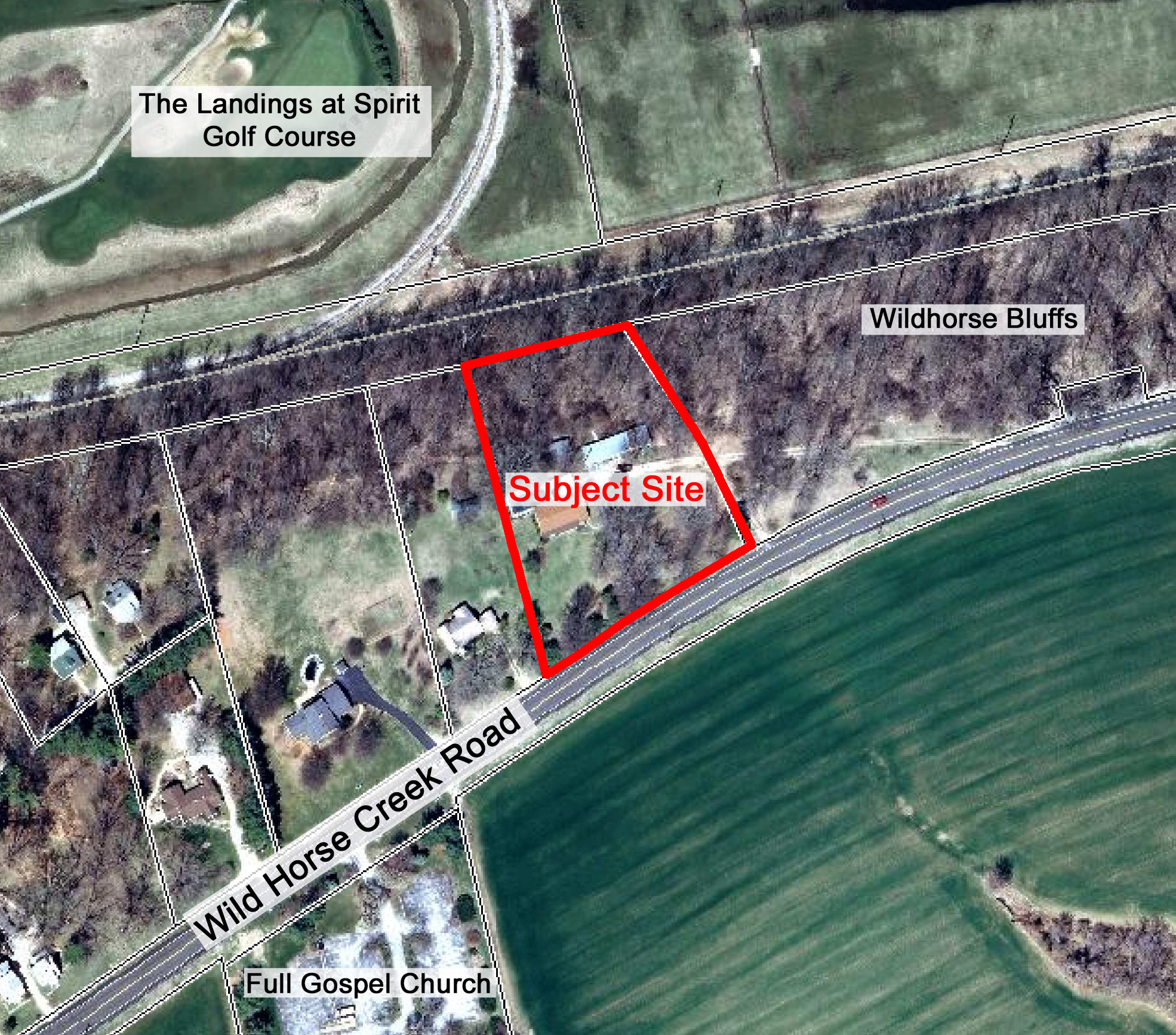
For a larger image of the site, please click here.
Anyone interested in the proceedings will be given an opportunity to be heard. Copies of the request are available for review in the Department of Planning and Public Works at Chesterfield City Hall, 690 Chesterfield Parkway West during weekdays between the hours of 8:30 a.m. and 4:30 p.m. If you should need additional information about this project, please contact Mr. Kristian Corbin, Project Planner, by telephone at 636-537-4743 or by email at kcorbin@chesterfield.mo.us
CITY OF CHESTERFIELD
G. Elliot Grissom, Chair
Chesterfield Planning Commission
Description of Property
Adjusted Parcel 1 P.B. 353 P. 955 A tract of land being part of U.S. Survey No. 150, Township 45 North, Range 3 East of the 5th P.M., St. Louis County, Missouri and being more particularly described as follows:
Commencing from the intersection of the South right-of-way of the Chicago, Rock Island Railroad with the East Line of U.S. Survey No. 150; thence along said South right-of-way S 77 05'00" W 755.79 feet to a set iron rod at the point of beginning of the tract of land described herein; thence leaving said South right-of-way S 47 49'24" E 139.17 feet to a set iron rod: thence S 19 44' 19" E 174.03 feet to a set iron rod on the North right-of-way line of Wild Horse Creek Road, 60 feet wide; thence along said right-of-way along a curve deflecting to the left having a radius of 1940.08 feet an arc length of 174.12 feet a chord course S 57 48' 17' W 174.06 feet; thence S 55 14' 00" W 65.83 feet; thence leaving said right-of-way N 12 21' 59" W 368.92 feet to the south right-of-way of the Chicago, Rock Island Railroad; thence along said South right-of-way N 77 05' 00" E 121.55 feet to the point of beginning, containing 1.47 acres, more or less.