T.S.P 37-2011 AT&T (14804 Clayton Road)
NOTICE OF PUBLIC HEARING
CITY OF CHESTERFIELD
PLANNING COMMISSION
NOTICE IS HEREBY GIVEN that the Planning Commission of the City of Chesterfield will hold a Public Hearing on Monday, October 24, 2011, at 6:30 p.m. in the Council Chambers at the City Hall, 690 Chesterfield Parkway West, Chesterfield, Missouri 63017.
Said hearing will be as follows:
T.S.P 37-2011 AT&T (14804 Clayton Road): A request to obtain approval for a Telecommunication Facility Siting Permit for a collocation of additional antennas and equipment on an existing stealth tower in a "PC" Planned Commercial District-zoned property located at 14804 Clayton Road on the south side of Clayton Road west of Wildwood Parkway (21R420714).
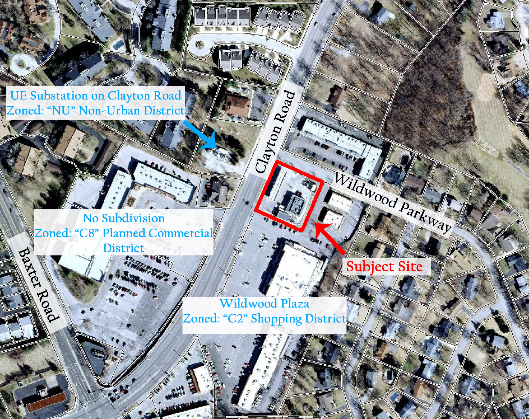
For a larger image of the site, please click HERE.
Anyone interested in the proceedings will be given an opportunity to be heard. Copies of the request are available for review in the Department of Planning and Public Works at Chesterfield City Hall, 690 Chesterfield Parkway West during weekdays between the hours of 8:30 a.m. and 4:30 p.m. If you should need additional information about this project, please contact Mr. Kristian Corbin, Project Planner, by telephone at 636-537-4743 or by email at kcorbin@chesterfield.mo.us
CITY OF CHESTERFIELD
Amy Nolan, Chair
Chesterfield Planning Commission
Description of Property
A tract of land being part section 26, township 45 north, range 4 east, St. Louis County, Missouri, being more particularly described as follows:
Commencing at the northeast corner of a tract of land conveyed by deed to Shell Oil Company recorded in deed book 5311 page 260 of the St. Louis County Records, said point also being a northwest corner of a tract of land conveyed by deed to Marry Ann and John N. Hutkin recorded in deed book 10451 page 1419 of the St. Louis County records, said point also being on the southern line of Wildwood Parkway variable width, thence southerly along said eastern line of said Shell Oil Company tract south 22 degrees 48 minutes 35 seconds west a distance of 200.00 feet to the south corner of said Shell Oil Company tract north 67 degrees 11 minutes 25 seconds west a distance of 60.00 feet to a point; thence northerly leaving the southern line of said Shell Oil Company tract north 22 degrees 48 minutes 35 seconds east a distance of 200.00 feet to a point on the northern line of said Shell Oil Company tract; thence easterly along said northern line of Shell Oil Company tract south 67 degrees 11 minutes 25 seconds east a distance of 60.00 feet to the point of beginning containing 12,000 square feet or .0275 acres more or less.